West McArthur JV Extends Uranium Targets in Latest Drill Program
High-Grade Mineralization Intersected Including 1.62% eU3O8 over 2.6 Metres Strong Alteration and Large Fault Structures Intersected 1.8 km Southwest Along “42 Zone” Corridor Joint Venture Doubles 2022 Exploration Program Budget to $5 Million Vancouver, Canada, December 16, 2021 – CanAlaska Uranium Ltd. (TSX-V: CVV; OTCQB: CVVUF; Frankfurt: DH7N) (“CanAlaska” or the “Company”) is pleased to […]
NE Wollaston
Location The NE Wollaston projects consist of four claim groupings totalling 29,671 hectares, located 60 kilometres northeast of Cameco’s Rabbit Lake mill and Eagle Point mine (Figure 1). Geology The project areas cover the Collins Bay Fault, host to the Rabbit Lake, Collins Bay A, B and D, and Eagle Point orebodies, beyond the edge […]
Geikie
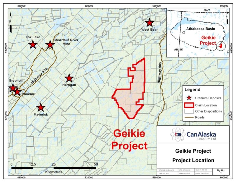
CanAlaska’s Geikie property, totaling 33,897 ha, is located 7 km Southeast of the present-day Athabasca Basin edge, in Saskatchewan, Canada. The property straddles the extension of a fertile corridor of biotite gneisses hosting the Agip S high-grade uranium showing (up to 58% U3O8), and the recent Baselode Energy radioactive intersections near Beckett Lake. These […]
Frontier
CanAlaska’s Frontier property, totaling 15,929 ha, is located in the northeastern Athabasca Basin. The project is five kilometres northeast of the present-day Athabasca Basin edge along the regional-scale Roughrider Mineralized Corridor (RMC). The RMC is host to multiple uranium deposits and showings, including Roughrider, Midwest, J Zone, Dawn Lake, Moonlight, Osprey, and the McClean Lake […]
Enterprise
CanAlaska’s Enterprise property, totaling 12,060 ha, is located in the southeastern Athabasca Basin. The project is twenty kilometres south of the present-day Athabasca Basin edge and the Key Lake Mine and Mill complex along Highway 914. Historical exploration on the project consists of prospecting and geological mapping that were completed in conjunction with airborne […]
North Millennium
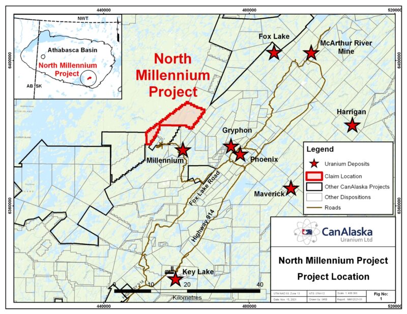
CanAlaska’s North Millennium property, totaling 5,873 ha, is located in the Eastern Athabasca Basin, Saskatchewan, Canada. The property is located seven km from Cameco’s Millennium uranium deposit. Northeast trending conductors on the project are disrupted and offset by a North-South trending lineament that can be traced down through the Millennium deposit. This North-South feature […]
McTavish
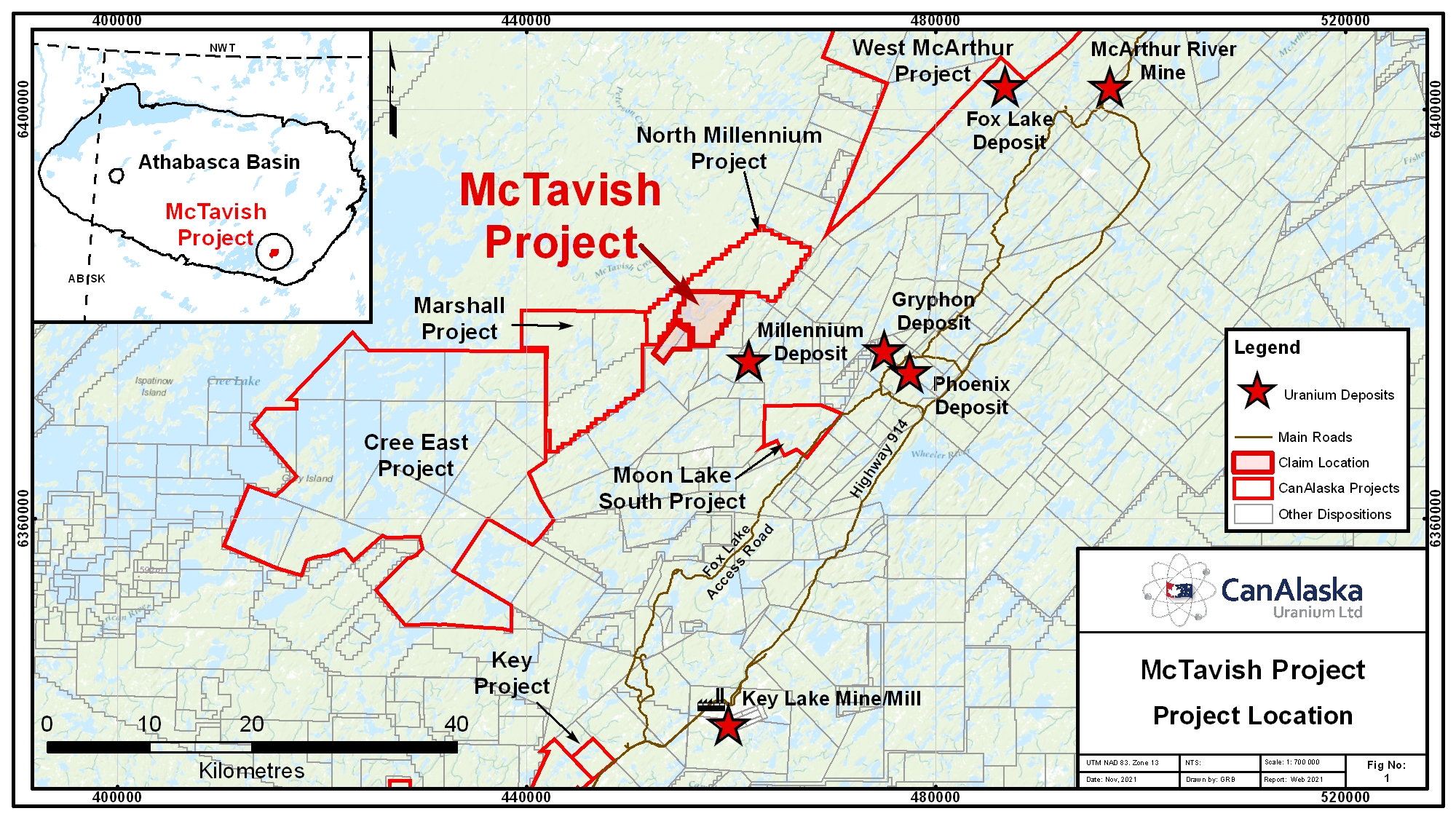
CanAlaska’s McTavish property, totaling 2,685 ha, is located in the Eastern Athabasca Basin, Saskatchewan, Canada. The project is located 5 km northwest of Cameco’s Millennium uranium deposit. The project area has been periodically explored for unconformity-type uranium deposits since the late 1970’s with work on and adjacent to the project consisting of airborne and […]
Marshall
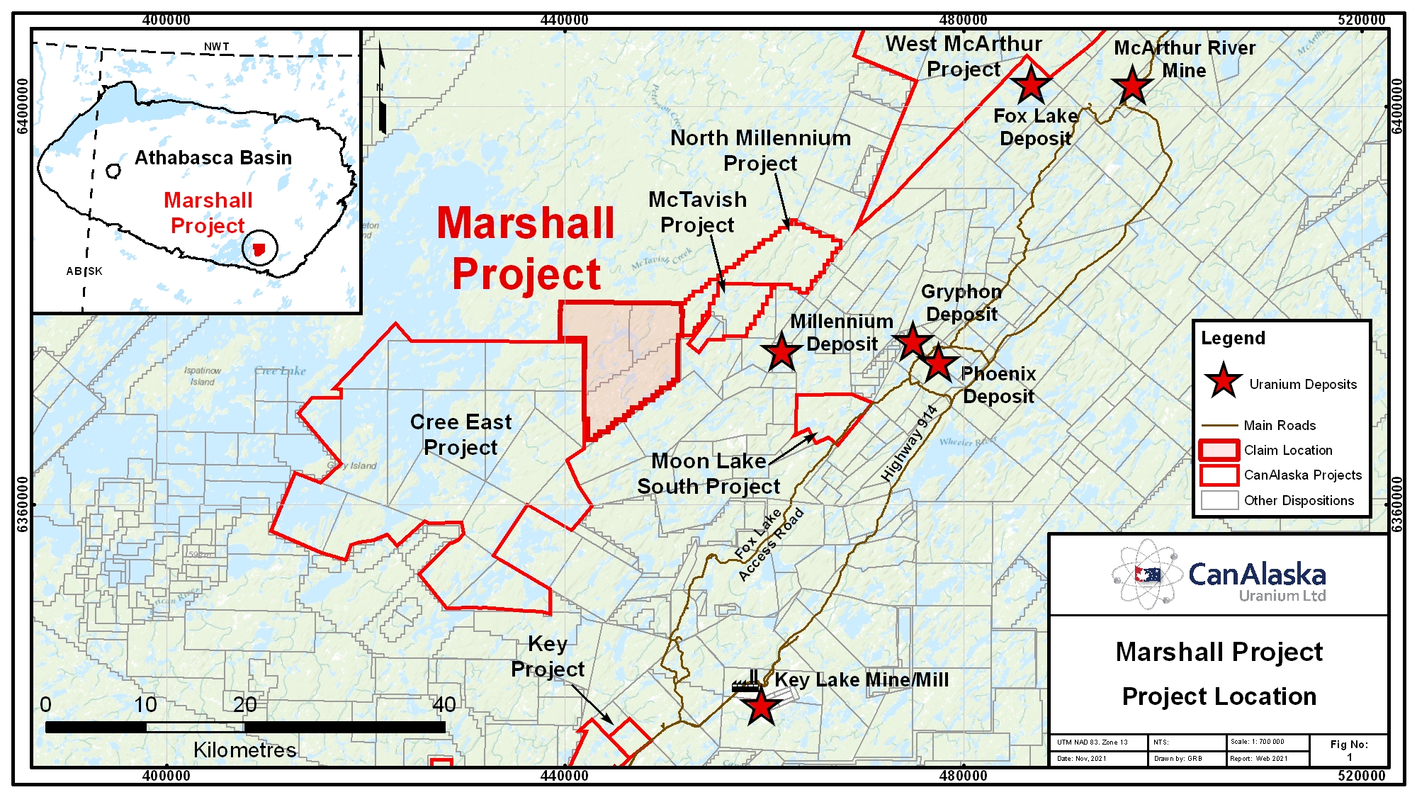
CanAlaska’s Marshall property, totaling 11,225 ha, is located in the Eastern Athabasca Basin, Saskatchewan, Canada. The project is 11 km west of Cameco’s Millennium uranium deposit. The project area has been subject to minimal historical exploration for unconformity-type uranium deposits, mainly centered airborne and ground geophysical surveys, and boulder prospecting. No diamond drilling has […]
Chymko
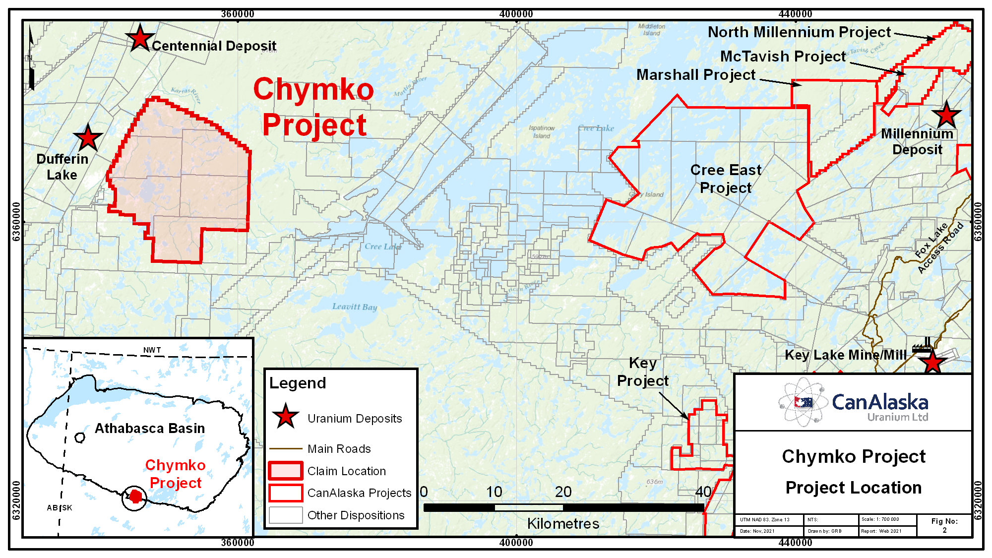
CanAlaska’s Chymko property, totaling 32,603 ha, straddles the south-central edge of the present-day Athabasca Basin in Saskatchewan, Canada. The property is adjacent to the Virgin River Shear Zone, which hosts the Centennial and Dufferin Lake unconformity uranium deposits. The project area has been historically explored by regional airborne geophysical and ground lake sediment surveys. […]
Carswell
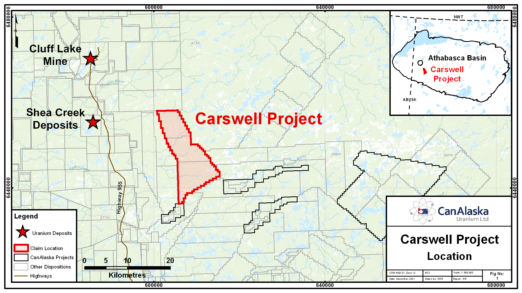
CanAlaska’s Carswell property, totaling 13,352 ha, is located in the western Athabasca Basin, Saskatchewan, Canada. Within the western Athabasca Basin, some of the most significant undeveloped uranium resources exist in the Shea Creek, Triple R, and Arrow deposits. The property covers a conductive structural corridor that joins the Beatty River fault zone to Carswell […]
Moon Lake South
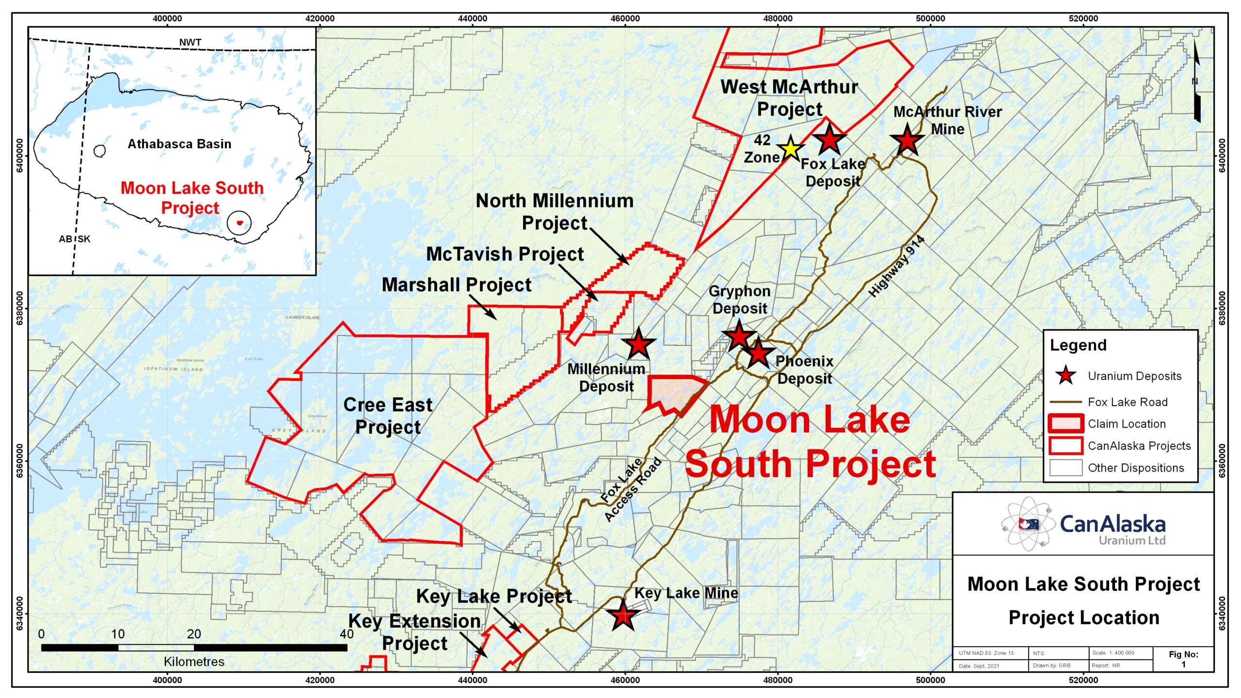
CanAlaska holds a 25% ownership in the Moon Lake South JV operated by our partner Denison Mines Corporation. The property is host to a five km long Northeast trending conductive corridor known as the CR-3 conductor. The CR-3 conductor is located two kilometres west of the K-trend, host to the Gryphon Deposit on Denison’s […]
Taggart
CanAlaska’s Taggart property, totalling 28,328 ha, is located in the western Athabasca Basin, Saskatchewan, Canada. The property is 60 km northeast of the Triple R and Arrow uranium deposits along the mineralized Patterson Lake Corridor. Geophysical and geological compilation work suggest that the basement rocks of the Patterson Lake Corridor, consisting of granitic to […]
NW Manitoba
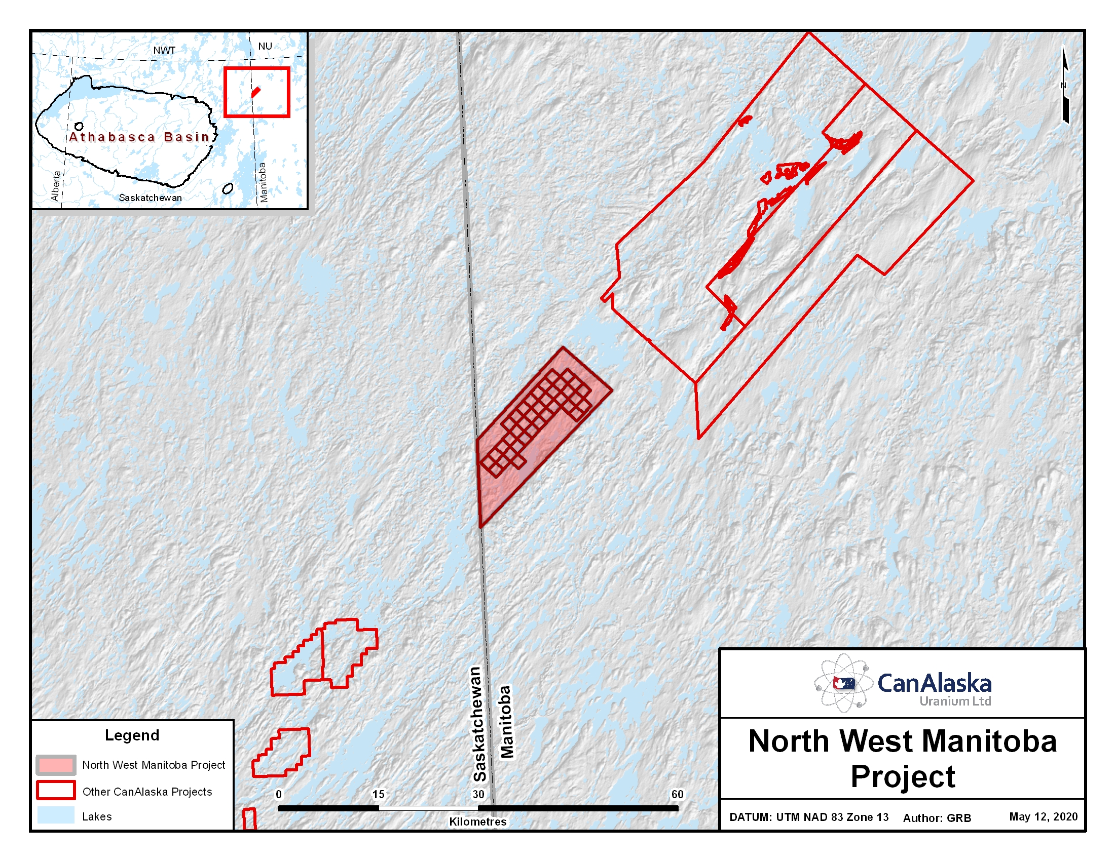
Location The project lies in northwest Manitoba just east of the border of northeast Saskatchewan. It is 70 km north of Reindeer Lake and covers 143,603 hectares. The project has similar geology to areas which include the Rabbit Lake, Collins Bay and Eagle Point Uranium mines 90 kilometres to the South West. Geology The […]
Patterson West Project
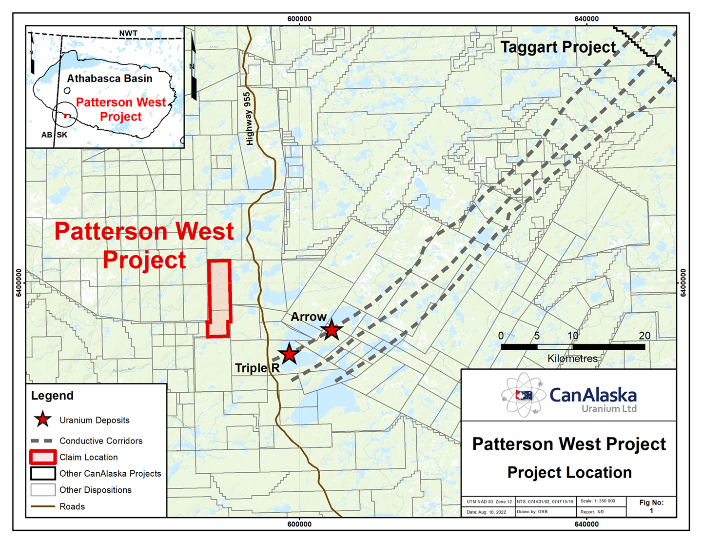
CanAlaska’s Patterson West property, totaling 3,015 ha, is located in the Patterson Lake area of the Athabasca Basin. The project straddles the southwestern edge of the present-day Athabasca Basin in Saskatchewan Canada. The Patterson West project is located 10 – 15 km west of the Triple R and Arrow uranium deposits. A VTEMmax airborne […]
Watson
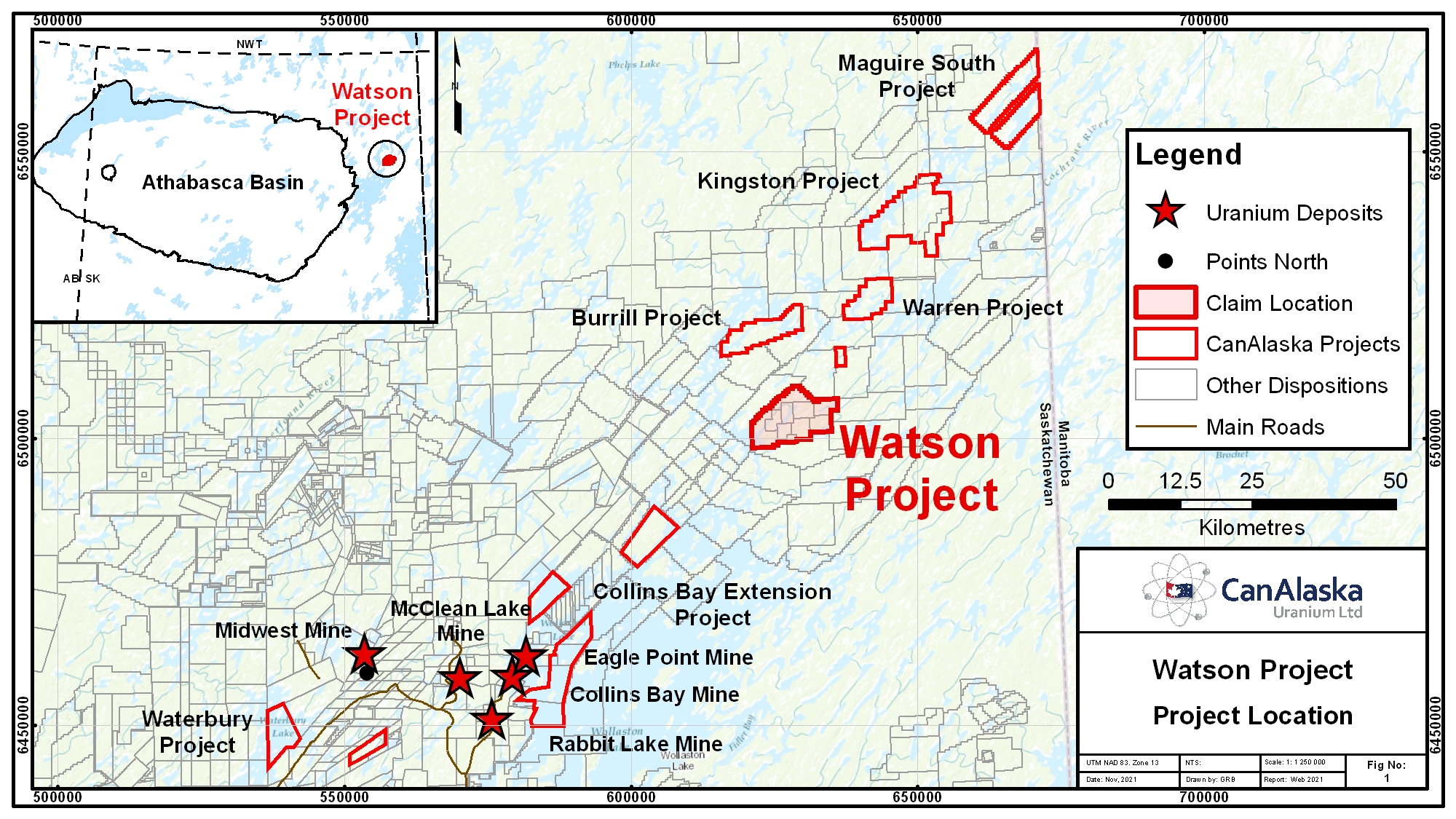
CanAlaska’s Watson property, totaling 10,085 ha, is located 55 km from the northeastern margin of the present-day Athabasca Basin, Saskatchewan, Canada. The Watson project is part of CanAlaska’s NE Wollaston land package, where the main target is basement-hosted uranium deposits similar to Eagle Point or Arrow. The project is located on a portion of a […]
Warren
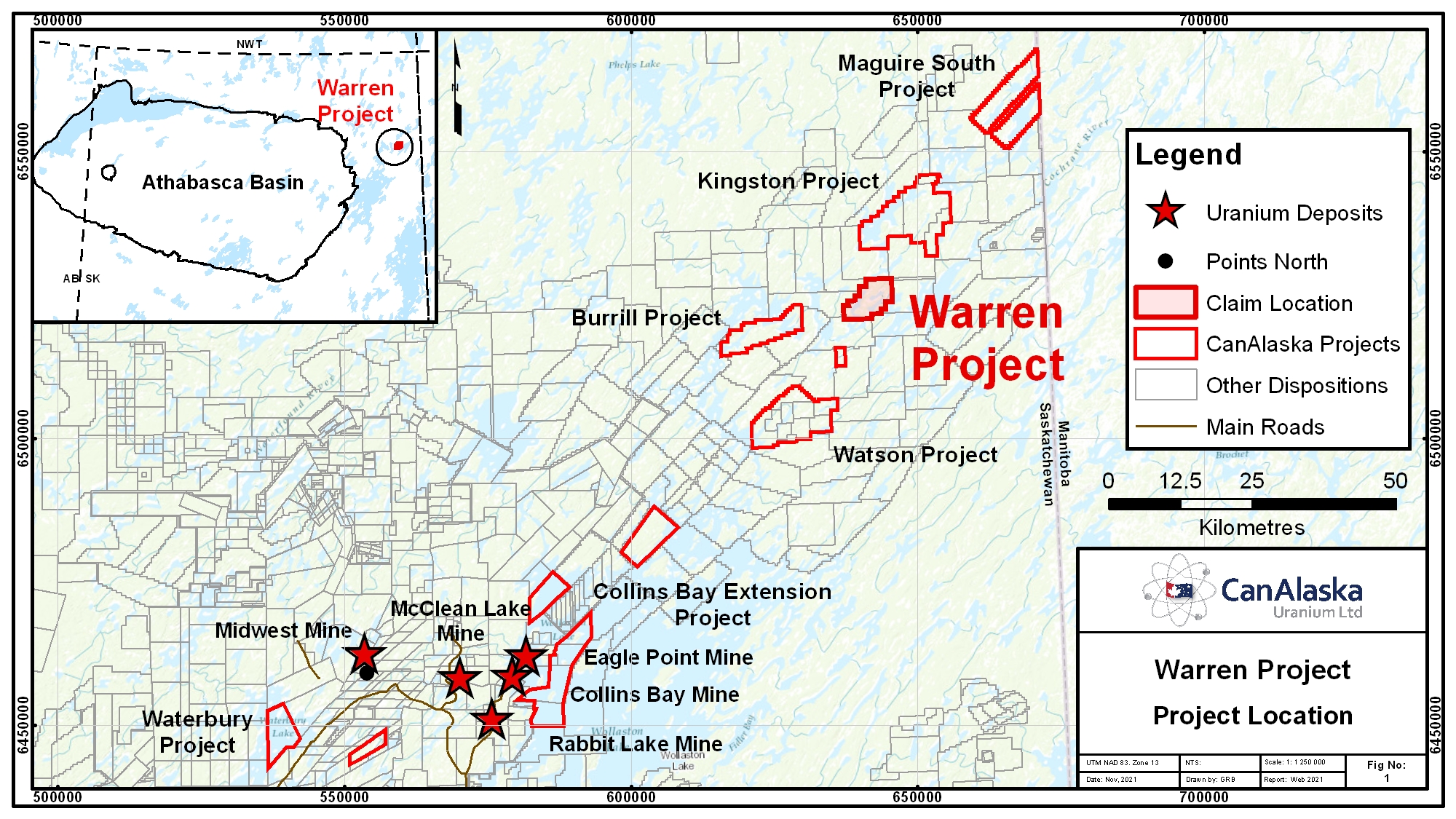
CanAlaska’s Warren property, totaling 4,901 ha, is located 75 km from the northeastern margin of the present-day Athabasca Basin, Saskatchewan, Canada. The Warren project is part of CanAlaska’s NE Wollaston land package, where the main target is basement-hosted uranium deposits similar to Eagle Point or Arrow. The project is located Northeast of the Watson […]
Kingston
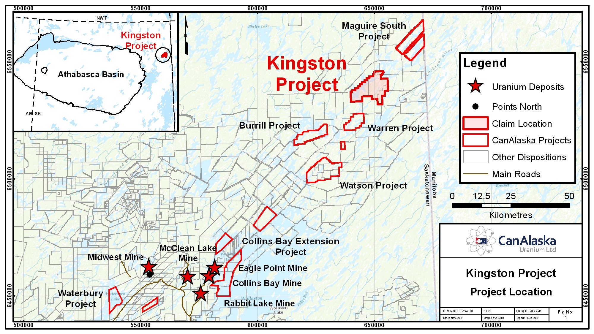
CanAlaska’s Kingston property, totaling 12,769 ha, is located 90 km from the northeastern margin of the present-day Athabasca Basin, Saskatchewan, Canada. The Kingston project is part of CanAlaska’s NE Wollaston land package, where the main target is basement-hosted uranium deposits similar to Eagle Point or Arrow. The property is host to the extension of […]
Burrill
CanAlaska’s Burrill property, totaling 5,601 ha, is located 60 km from the northeastern margin of the present-day Athabasca Basin, Saskatchewan, Canada. The Burrill project is part of CanAlaska’s NE Wollaston land package, where the main target is basement-hosted uranium deposits similar to Eagle Point or Arrow. The property is located Southeast of the Kingston […]
Waterbury East
CanAlaska’s Waterbury East property, totaling 1,337 ha is located in the northeastern Athabasca Basin, Saskatchewan, Canada. The project has approximately 200 m of Athabasca sandstone cover overlying the basement rocks of the Wollaston Domain. The claim has been subject to historical regional and project scale ground and airborne geophysical surveys that highlight at 7 […]
CanAlaska Identifies Uranium Targets in Western Athabasca
15 Kilometre Strongly Conductive Target Corridor Identified Corridor Mirrors Saskatoon Lake Conductor – Host to the Large Shea Creek Uranium Deposits Vancouver, Canada, December 9, 2021 – CanAlaska Uranium Ltd. (TSX-V: CVV; OTCQB: CVVUF; Frankfurt: DH7N) (“CanAlaska” or the “Company”) is pleased to announce that compilation work on the Company’s newly acquired Carswell project, totalling […]
Tagged 2021